
Storm Bert. A major incident declared. Northampton Railway Station shut. A severe “danger to life” warning issued at Billing Aquadrome. Northamptonshire does not flood from upstream — it generates the water that floods everywhere else.
Published June 2026 · RISE Flood Recovery Consultancy
Northamptonshire occupies a unique position in the geography of England. It sits at the watershed — the high ground from which rainfall drains away in multiple directions. Water falling on Northamptonshire flows into the River Nene, which drains east to the Wash and the North Sea. It flows into the River Welland on a similar route. And it flows into the headwaters of the Great Ouse and the Cherwell, which drain south towards the Thames.
This geography has consequences. Northamptonshire does not receive floodwater from upstream in the way that communities downstream on the Thames or the Severn do. But it generates floodwater — from rainfall that overwhelms a drainage network built for an earlier era, and from rivers that respond rapidly to intense local rainfall.
And in November 2024, Storm Bert showed exactly what that means in practice.
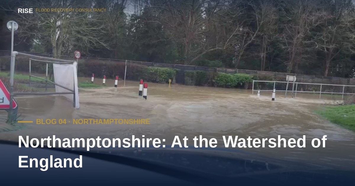
On 25 November 2024, the emergency services declared a major incident in Northamptonshire. The River Nene was, in the words of one weather observer, “in full flood”. A severe flood warning — the Environment Agency classification used to indicate danger to life — was issued for the Nene at Billing Aquadrome. Northampton Railway Station shut. Schools across the county closed. A holiday park near Northampton was evacuated for the second time in a matter of weeks.
It was not an isolated event. In January 2025, fresh flood alerts were issued for the Middle Nene, Harpers Brook and Willow Brook after further sustained rainfall. The pattern is now familiar across the four counties this series covers: one storm, then another, the ground saturated, the rivers responding faster than the infrastructure designed to contain them.
The River Nene runs through the heart of Northamptonshire, passing through Northampton, Wellingborough, Rushden and Thrapston before leaving the county. Floodplain communities along the Nene have experienced repeated flooding events, particularly in years of sustained winter rainfall.
Northampton itself — a major urban centre — has areas within Environment Agency Flood Zone 3, with properties in the floodplain of the Nene and its tributaries at risk of flooding in a 1 in 100 year event from rivers. As climate change increases the frequency of extreme rainfall, the return period of what was once called a 1 in 100 year flood is shortening.
Like all four counties in this series, Northamptonshire's surface water flood risk is growing faster than its fluvial risk. Intense convective storms — the localised but extreme summer downpours produced when a warm atmosphere holds more moisture — are increasingly affecting communities that would not traditionally think of themselves as flood risk areas.
West Northamptonshire Council and North Northamptonshire Council both manage flood risk through their roles as Lead Local Flood Authorities. West Northamptonshire's flood investigation register was last updated in February 2026, with new Section 19 investigations being added across the area. These reports — the formal mechanism by which councils are required to investigate floods, to the extent they consider necessary or appropriate, — are being triggered repeatedly across the county as surface water flooding overwhelms highway drainage in communities where infrastructure has not kept pace with development. (See the Section 19 Reference Manual for the full statutory framework.)
Northamptonshire is home to several major reservoirs, including Pitsford, Hollowell, Ravensthorpe and Naseby. While these are managed assets with rigorous safety regimes, reservoir flood risk is a formally recognised category in the Environment Agency's national flood mapping. Properties downstream of reservoirs carry a distinct risk profile that standard flood insurance may not fully address.
This is not a reason for alarm — reservoir safety in the UK is among the most rigorous in the world — but it is a factor that homeowners in downstream communities should be aware of when assessing their flood risk profile.
Northamptonshire does not appear in national flood headlines as often as counties like Somerset, Yorkshire or Gloucestershire. But the absence of national coverage does not mean the absence of risk. It means the risk is distributed across many smaller communities, each experiencing localised flooding events that rarely reach the threshold for national news.
For homeowners in those communities, the experience is identical to those who flood in higher-profile events: a ruined home, a displaced family, a complex insurance claim, and a recovery process that can take years. The scale of the media coverage does not change the scale of the personal impact.
Three things every Northamptonshire homeowner can do in under thirty minutes — and most never have:
Check your property's flood risk on the updated NaFRA2 data. The Environment Agency's free service at check-for-flooding.service.gov.uk was updated in January 2025 with higher-resolution modelling and the latest climate projections. Northamptonshire homes that previously sat outside any flood zone may now be classified as at risk — particularly from surface water. If you have not checked since then, your property's official rating may have changed.
Look up Section 19 flood investigation reports for your area. Both West Northamptonshire Council and North Northamptonshire Council publish their flood investigations openly. If your area has flooded since 2010, the cause may already have been investigated and the responsible parties identified.
Sign up to Environment Agency flood warnings. Free, by phone, text or email. The county's main rivers — the Nene, the Welland, the Ise, the Tove, the Jordan, and the Great Ouse headwaters — are all covered by the warning service. Coverage is for main rivers only, so surface water flooding still requires you to read the weather and act on your own observations.
Sources and further reading: BBC News live coverage of Storm Bert in Northamptonshire (25 November 2024); Northants Telegraph reports on Middle Nene, Harpers Brook and Willow Brook flood alerts (January 2025); West Northamptonshire Council Flood Investigation Reports (Section 19s), last updated February 2026; North Northamptonshire Council flood pages; Environment Agency Check for Flooding service; West Northamptonshire Council news release on partnership flood management work (September 2024).
No obligation. No jargon. By the end of the call you will have a clear view of your options — whether you engage RISE or not.
Call any time No callback RISE directly
Live data from the Environment Agency, refreshed every 15 minutes.
Help us focus future content
RISE is researching gaps in publicly available flood recovery information. If you have 90 seconds, your responses help us understand what homeowners actually struggle to find clear answers on — and shape what we write next.
Take the 90-second survey →